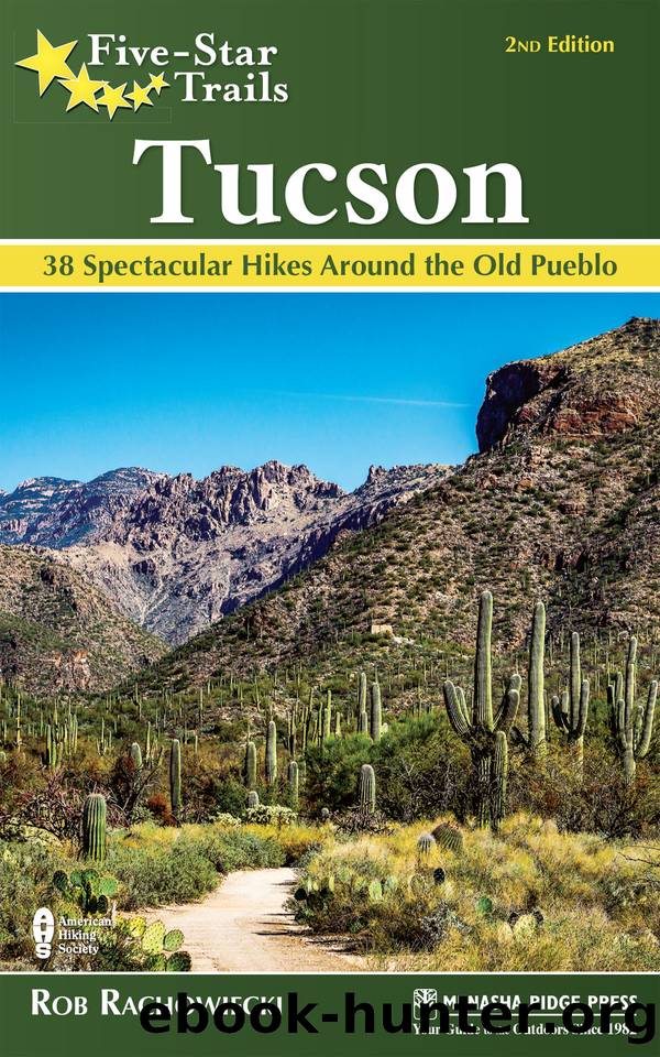
Five-Star Trails: Tucson by Rachowiecki Rob;
Author:Rachowiecki, Rob;
Language: eng
Format: epub
ISBN: 5969039
Publisher: Menasha Ridge Press
Published: 2019-09-15T00:00:00+00:00
RAPPEL ROCK
GPS TRAILHEAD COORDINATES: N32° 26.416' W110° 47.151'
DISTANCE & CONFIGURATION: 1.6-mile loop, 2.1 miles with side trip to lookout
HIKING TIME: 1-hour loop, 1.5 hours with side trip
HIGHLIGHTS: Fine views of Tucson; exceptional views from lookout; pretty meadows surrounded by coniferous forest
ELEVATION: 9,100' at trailhead, 8,800' at low point
ACCESS: Open daily, 24/7; parking $5/$10/$20 for day/week/year; all National Park Service annual passes accepted
MAPS: Green Trails Map 2886SâSanta Catalina Mountains, USFS Pusch Ridge Wilderness
FACILITIES: Pit toilets at trailhead; parking for about 20 cars (no trailers or RVs)
WHEELCHAIR ACCESS: Toilets only
COMMENTS: Horses allowed but rarely encountered. Dogs must be leashed at all times. If the parking area is full, look for spaces along the road to the trailhead or in the unmarked parking area near the top of the ski area, about 0.2 mile back along the road on the south side. The trail and road may be closed by snow in the winterâbut itâs a short winter in southern Arizona!
CONTACTS: Sabino Canyon Visitor Center, 520-749-8700, fs.usda.gov/coronado
Download
This site does not store any files on its server. We only index and link to content provided by other sites. Please contact the content providers to delete copyright contents if any and email us, we'll remove relevant links or contents immediately.
| General | Grand Canyon |
| Phoenix | Tucson |
Giovanni's Room by James Baldwin(6814)
The Plant Paradox by Dr. Steven R. Gundry M.D(2430)
The Stranger in the Woods by Michael Finkel(2328)
Miami by Joan Didion(2166)
Wild: From Lost to Found on the Pacific Crest Trail by Cheryl Strayed(2133)
INTO THE WILD by Jon Krakauer(2086)
Trail Magic by Trevelyan Quest Edwards & Hazel Edwards(2063)
DK Eyewitness Top 10 Travel Guides Orlando by DK(2058)
Vacationland by John Hodgman(2033)
The Twilight Saga Collection by Stephenie Meyer(2029)
Nomadland by Jessica Bruder(1959)
Birds of the Pacific Northwest by Shewey John; Blount Tim;(1875)
The Last Flight by Julie Clark(1832)
Portland: Including the Coast, Mounts Hood and St. Helens, and the Santiam River by Paul Gerald(1820)
On Trails by Robert Moor(1794)
Deep South by Paul Theroux(1718)
Blue Highways by William Least Heat-Moon(1664)
Trees and Shrubs of the Pacific Northwest by Mark Turner(1645)
1,000 Places to See in the United States and Canada Before You Die (1,000 Places to See in the United States & Canada Before You) by Patricia Schultz(1557)
